Silex, Missouri
| Silex, Missouri | |
|---|---|
| Village | |
 Location of Silex, Missouri | |
| Coordinates: 39°7′23″N 91°3′27″W / 39.12306°N 91.05750°WCoordinates: 39°7′23″N 91°3′27″W / 39.12306°N 91.05750°W | |
| Country | United States |
| State | Missouri |
| County | Lincoln |
| Area[1] | |
| • Total | 0.19 sq mi (0.49 km2) |
| • Land | 0.19 sq mi (0.49 km2) |
| • Water | 0 sq mi (0 km2) |
| Elevation | 499 ft (152 m) |
| Population (2010)[2] | |
| • Total | 187 |
| • Estimate (2012[3]) | 236 |
| • Density | 984.2/sq mi (380.0/km2) |
| Time zone | Central (CST) (UTC-6) |
| • Summer (DST) | CDT (UTC-5) |
| ZIP code | 63377 |
| Area code(s) | 573 |
| FIPS code | 29-67808[4] |
| GNIS feature ID | 0726439[5] |
Silex is a village in Lincoln County, Missouri, United States. The population was 187 at the 2010 census.
History
Silex had its start in the 1880s when the railroad was extended to that point.[6] A post office called Silex has been in operation since 1882.[7] The community was named for production of silex.[6]
Geography
Silex is located at 39°7′23″N 91°3′27″W / 39.12306°N 91.05750°W (39.122968, -91.057371).[8]
According to the United States Census Bureau, the village has a total area of 0.19 square miles (0.49 km2), all of it land.[1]
Duncan Mansion is located in Silex, MO
Demographics
| Historical population | |||
|---|---|---|---|
| Census | Pop. | %± | |
| 1890 | 151 | — | |
| 1900 | 210 | 39.1% | |
| 1910 | 276 | 31.4% | |
| 1920 | 267 | −3.3% | |
| 1930 | 251 | −6.0% | |
| 1940 | 240 | −4.4% | |
| 1950 | 188 | −21.7% | |
| 1960 | 176 | −6.4% | |
| 1970 | 306 | 73.9% | |
| 1980 | 287 | −6.2% | |
| 1990 | 197 | −31.4% | |
| 2000 | 206 | 4.6% | |
| 2010 | 187 | −9.2% | |
| Est. 2015 | 283 | [9] | 51.3% |
2010 census
As of the census[2] of 2010, there were 187 people, 57 households, and 37 families residing in the village. The population density was 984.2 inhabitants per square mile (380.0/km2). There were 84 housing units at an average density of 442.1 per square mile (170.7/km2). The racial makeup of the village was 97.9% White and 2.1% African American.
There were 57 households of which 29.8% had children under the age of 18 living with them, 36.8% were married couples living together, 21.1% had a female householder with no husband present, 7.0% had a male householder with no wife present, and 35.1% were non-families. 29.8% of all households were made up of individuals and 8.8% had someone living alone who was 65 years of age or older. The average household size was 2.53 and the average family size was 3.16.
The median age in the village was 38.8 years. 22.5% of residents were under the age of 18; 10.1% were between the ages of 18 and 24; 21.4% were from 25 to 44; 33.7% were from 45 to 64; and 12.3% were 65 years of age or older. The gender makeup of the village was 51.9% male and 48.1% female.
2000 census
As of the census[4] of 2000, there were 206 people, 80 households, and 59 families residing in the village. The population density was 1,074.5 people per square mile (418.6/km²). There were 91 housing units at an average density of 474.6 per square mile (184.9/km²). The racial makeup of the village was 99.03% White, and 0.97% from two or more races.
There were 80 households out of which 33.8% had children under the age of 18 living with them, 53.8% were married couples living together, 16.3% had a female householder with no husband present, and 26.3% were non-families. 21.3% of all households were made up of individuals and 6.3% had someone living alone who was 65 years of age or older. The average household size was 2.58 and the average family size was 2.97.
In the village the population was spread out with 26.2% under the age of 18, 8.7% from 18 to 24, 33.0% from 25 to 44, 18.4% from 45 to 64, and 13.6% who were 65 years of age or older. The median age was 37 years. For every 100 females there were 106.0 males. For every 100 females age 18 and over, there were 97.4 males.
The median income for a household in the village was $24,531, and the median income for a family was $33,125. Males had a median income of $30,313 versus $19,167 for females. The per capita income for the village was $12,529. About 11.3% of families and 12.5% of the population were below the poverty line, including 10.4% of those under the age of eighteen and none of those sixty five or over.
References
- 1 2 "US Gazetteer files 2010". United States Census Bureau. Retrieved 2012-07-08.
- 1 2 "American FactFinder". United States Census Bureau. Retrieved 2012-07-08.
- ↑ "Population Estimates". United States Census Bureau. Retrieved 2013-05-30.
- 1 2 "American FactFinder". United States Census Bureau. Retrieved 2008-01-31.
- ↑ "US Board on Geographic Names". United States Geological Survey. 2007-10-25. Retrieved 2008-01-31.
- 1 2 "Lincoln County Place Names, 1928–1945 (archived)". The State Historical Society of Missouri. Archived from the original on June 24, 2016. Retrieved October 28, 2016.
- ↑ "Post Offices". Jim Forte Postal History. Retrieved 26 October 2016.
- ↑ "US Gazetteer files: 2010, 2000, and 1990". United States Census Bureau. 2011-02-12. Retrieved 2011-04-23.
- ↑ "Annual Estimates of the Resident Population for Incorporated Places: April 1, 2010 to July 1, 2015". Retrieved July 2, 2016.
- ↑ "Census of Population and Housing". Census.gov. Retrieved June 4, 2015.
External links
- Historic maps of Silex in the Sanborn Maps of Missouri Collection at the University of Missouri
Municipalities and communities of Lincoln County, Missouri, United States | ||
|---|---|---|
| Cities | 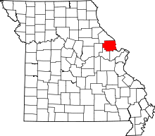 | |
| Villages | ||
| Townships | ||
| Unincorporated communities | ||
| Ghost towns | ||