Loc-Eguiner-Saint-Thégonnec
| Loc-Eguiner-Saint-Thégonnec Logeginer-Sant-Tegoneg | |
|---|---|
|
The church in Loc-Eguiner-Saint-Thégonnec | |
 Loc-Eguiner-Saint-Thégonnec | |
|
Location within Brittany region 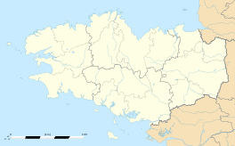 Loc-Eguiner-Saint-Thégonnec | |
| Coordinates: 48°27′49″N 3°58′06″W / 48.4636°N 3.9683°WCoordinates: 48°27′49″N 3°58′06″W / 48.4636°N 3.9683°W | |
| Country | France |
| Region | Brittany |
| Department | Finistère |
| Arrondissement | Morlaix |
| Canton | Saint-Thégonnec |
| Intercommunality | Morlaix |
| Government | |
| • Mayor (2014–2020) | Françoise Raoult |
| Area1 | 8.02 km2 (3.10 sq mi) |
| Population (2008)2 | 322 |
| • Density | 40/km2 (100/sq mi) |
| Time zone | CET (UTC+1) |
| • Summer (DST) | CEST (UTC+2) |
| INSEE/Postal code | 29127 / 29410 |
| Elevation | 83–181 m (272–594 ft) |
|
1 French Land Register data, which excludes lakes, ponds, glaciers > 1 km² (0.386 sq mi or 247 acres) and river estuaries. 2 Population without double counting: residents of multiple communes (e.g., students and military personnel) only counted once. | |

Loc-Eguiner-Saint-Thégonnec (Breton: Logeginer-Sant-Tegoneg) is a former commune in the Finistère department of Brittany in north-western France. On 1 January 2016, it was merged into the new commune Saint-Thégonnec Loc-Eguiner.[1]
Population
Inhabitants of Loc-Eguiner-Saint-Thégonnec are called in French Éguinériens.
| Historical population | ||
|---|---|---|
| Year | Pop. | ±% |
| 1876 | 702 | — |
| 1881 | 647 | −7.8% |
| 1886 | 644 | −0.5% |
| 1891 | 645 | +0.2% |
| 1896 | 625 | −3.1% |
| 1901 | 651 | +4.2% |
| 1906 | 675 | +3.7% |
| 1911 | 651 | −3.6% |
| 1921 | 561 | −13.8% |
| 1926 | 564 | +0.5% |
| 1931 | 539 | −4.4% |
| 1936 | 503 | −6.7% |
| 1946 | 448 | −10.9% |
| 1954 | 405 | −9.6% |
| 1962 | 418 | +3.2% |
| 1968 | 381 | −8.9% |
| 1975 | 366 | −3.9% |
| 1982 | 332 | −9.3% |
| 1990 | 319 | −3.9% |
| 1999 | 336 | +5.3% |
| 2008 | 322 | −4.2% |
See also
References
- ↑ Arrêté préfectoral 23 December 2015 (French)
- Mayors of Finistère Association (French);
| Wikimedia Commons has media related to Loc-Eguiner-Saint-Thégonnec. |
This article is issued from Wikipedia - version of the 1/20/2016. The text is available under the Creative Commons Attribution/Share Alike but additional terms may apply for the media files.